Fatehpur Sikri; ciudad de aguas
| Título | Fatehpur Sikri; ciudad de aguas |
|---|---|
| Del Curso | Poética de las Aguas |
| Carreras | Náutico y Marítimo"Náutico y Marítimo" is not in the list (Arquitectura, Diseño, Magíster, Otra) of allowed values for the "Carreras Relacionadas" property. |
| Alumno(s) | Asha Sumra |
Introduction: Water Architecture on the Indian Subcontinent

Just as Chile has a poetic relationship with the sea, India has a deeply poetic and spiritual relationship with its rivers, in all their forms. Within Hinduism, the primary religion of Hindustan (India), the sacred rivers of India are animate manifestations of the Gods. Contact with them is a sacred purifying act, in life and in death: in life, through bathing and offerings to the waters, and in death, through returning the ashes of a cremated body to the waters.

This sacred conception of the waters is inseparable from relation to physical geography, leading to a perception of ‘ground’(1) as something with which to simultaneously interact pragmatically and spiritually.
As a result, huge importance is placed on day-to-day practices of obtaining water, further heightened in areas where there is an extreme oscillation between abundance and scarcity of water due to aridity and the pattern of the seasonal monsoon.
This fundamental understanding is manifest in the traditions of Water Architecture of the Indian Subcontinent. Through which Hindu conceptions of water have become visibly intertwined with conceptions and practices of other Indic and Islamic religions to produce articulate artefacts. These speak of the history of response to water conditions on the subcontinent.

Examples date back to early civilizations. The Indus Valley Civilization (c 3300–1300 BC)(2), implemented one of the earliest known city drainage systems at Harappa and Mohenjo Daro (city dating to c. 2600 BC)(3) and created the earliest large scale dockyard at Lothal (city dating from c. 2400 BC)(4). The Great Bath at Mohenjo Daro is a precursor to the kund, a stepped pond that accesses groundwater or harvests rainwater and is commonly found either adjacent to a temple for sacred bathing or near to a settlement for use in either washing or for access to drinking water.

The Sacred importance attributed to rivers includes underground streams and ground water. In a Baoli, or stepwell, a stepped corridor provides both a literal and spiritual descent to sacred groundwater. Another example is Bhammaria, or retreat well, is where underground rooms surround the a well shaft to make pleasurable use of the cool environment below ground and adjacent to water, providing respite from the arid conditions and harsh sunlight that exist above ground.


The cistern at Nahargarh (constructed from 1732) articulates the topography in order to capture rainwater for use in the hilltop fort overlooking the city of Jaipur. These examples embody an approach towards inhabitation of the land that is driven by interaction with water.


(1)Ground, as a poetic conception includes both land and water (2)http://www.harappa.com/har/indus-saraswati.html. (3)http://www.bbc.co.uk/news/magazine-18491900. (4)S. R. Rao, Lothal ,1985.
Islamic Rule in India, Emperor Akbar and Fatehpur Sikri

Water Architecture in India emerged from Indic practices connected with water but developed within the context of widespread Islamic rule in India. An Indo-Muslim state first appeared in North India in 1206 with the establishment of the Delhi Sultanate(1206-1526)(5). Babur defeated the Sultanate In 1526 and established the Mughal Empire(1526-1857). The Empire overlapped with the provincial Sultanates, including the Gujarati Sultanate(1407-1573), where provincial rule continued until the Mughal Emperor Akbar’s conquest in 1573.
Indo-Islamic rule saw increasing urbanisation. New capitals were built at Tughlugabad(1321-27), Champaner(1484-1536) and Fatehpur Sikri (1571-1585)by the Delhi Sultanate, Gujarati Sultanate and Mughal Empire respectively. These cities proved to be short-lived replacements to sustained urban centres at Delhi, Agra and Ahmedabad respectively, and are therefore seen as experimental ideal city complexes.
Water Architecture and Islamic Rule in India arguably reached a peak as a synthesis of Indic and Islamic practices under the Mughal Rule of Emperor Akbar (1526-1857 AD), and is embodied in the construction of his new capital at Fatehpur Sikri (1571-1585 AD). The city was constructed 25 miles southwest of the former capital Agra(1565-1571), which continued as an economic and political centre, and was linked directly by road to Sikri. Petruccioli claims that in shifting the capital to Sikri, Akbar was decentralising the court to keep the nobility under better control(6).
Akbar ruled from 1556-1605, a period that re-asserted Mughal authority after instability under Humayan(1530-1543 and 1555-1556)and laid foundations for a century of stable Mughal rule, in a reign that is described as one of the most refined periods of Indian culture(7).
After Akbar’s conquest of Gujarat(1573), Sikri was known as Fatehpur Sikri(‘Victory City’), suggesting the influence of Gujarat and Gujarati architecture, on the city. This is particularly notable due to the strong traditions of water architecture in the Gujarat area. The city was abandoned in 1585, when Akbar moved to Lahore, for climatic preference and to be closer to vulnerable points of the empire, after the political and geographical centre had shifted towards Afghanistan(8).

The site of Sikri had significance to Akbar. Babur had marked Sikri by the construction of a ‘Victory garden’, including baolis and chahar bagh, to commemorate victory over Rana Sangam of Mewar in 1527. The site had further significance as the abode of Saint Salim Chisti, who predicted the birth of Akbar’s son Jahangir(Mughal Emperor 1605-1627). The citadel was constructed to honour the Saint, which in turn sanctified the site. Fatehpur Sikri is often described as a Utopian City. As through the construction of the city, Akbar sought to manifest his ambitions for the creation of a society and religion based on his understanding of all the major world religions. The refined red sandstone construction, is strongly articulated in terms of ornament and space. This builds on the traditions of the Northern Indian Sultanates where Hindu craftsmen where used to execute the architectural ambitions of Islamic rulers, resulting in a synthesis of traditional craft practices and an Islamic concept of space based on strong geometry and interconnections through water channels to represent an Islamic concept of paradise.
(5)Eaton, c.2000, p.250. (6)Ibid. (7)Ibid. (8)Petruccioli, 1984, p.21.
City Structure: Topography, Urban Order & Water Strategy


Fatehpur Sikri was built on a ridge approximately 40m high in modern day Uttar Pradesh. The citadel was designed as a constructed topography, which Nath perceives as receding terraces with the sacred complex(Sahn-i-Ibadat) at the heighest level, followed by the palace complex(Sahn-i- Khass), with the public court(Sahn-i-Rayyat) (9) at the lowest level. Terracing created a literal hierarchy descending from sacred to palatial and finally public, and facilitated the movement of water.
The location of the city resulted in problems of water supply. The lack of perennial water sources and seasonal rains suggested a reliance on groundwater. However the groundwater of this area was known to be brackish and saline(10). The complex’s location on the ridge led to the problem of supplying water to an elevated site. These issues were solved by the construction of an artificial lake, the harvesting of rainwater and run-off, and groundwater supply within mechanical systems for raising water.

The artificial lake was constructed by damming the seasonal river Kari-Nadi(11). Babur cites,
"an ocean-like reservoir,"
(12)
as a reason for constructing his encampment at Sikri, indicating that the lake existed before 1527. The lake provided a source for irrigation; mitigated the harsh climate; created a pleasing sheet of water and served as a defensive element for the northern part of the city, in lieu of the wall that surrounds the rest of the complex.

Rainwater at the sacred complex was collected in a square tank in front of the tomb of Shaikh Salim Chisti(13). This tank continues to be used as an ablution pool. Two birkhas also collected rainwater of the Jami Masjid. The most intriguing rainwater harvesting structure at the Jami Masjid is the Jhalra adjacent to the Buland Durwaza. The Jhalra has a similar form to a stepwell, but rather than sourcing groundwater collected rainwater water through underground channels(14).


At the royal complex, rainwater and run-off from the north waterworks was diverted into Char-Chamand tank. Overflow travelled to the kunda north of Diwan-i-Khass. Drainage at the public court was also diverted to this kunda, through a cascade and miniature pond(15). Drainage from the lower levels was diverted into Sukh tal, near Hakim’s baths. Water from the northeast slopes collected in a tank near the south baoli on the roadside, which was used by horses and elephants(16).

Two groundwater supply systems were part of mechanical systems for raising and conveying water that ensured a regular supply to the palace complex. The north waterworks was said to supply water to,
"all principal royal apartments."
(17)
Water was raised by rehant from the north Sangin baoli to the palace complex in five stages of elevation. Stages occurred at 1 the rehant chambers of the baoli, 2,3 two water-raising houses 4 the storage tank at the Elephant gate and finally at 5 the storage tank where water was transferred into the aqueduct of the palace complex(Fig 21.). At this stage water was distributed to the apartments. One channel conveyed water to Birbal’s Palace, and another to the Nagina Masjid apartments and adjoining hammam before emptying into the supply tank north of Jodh Bai’s palace. The main channel continued to Miriam’s garden.

In the south waterworks water was raised in 1 the rehant chambers of the south baoli and 2 the adjacent storage well. The system is ruined but Nath and CEPT(18) conjecture that water was raised in three further stages before being conveyed into an overhead channel towards the Khwabgah and Sultan’s baths. A simple rock-cut well supplied water to the royal baths and adjoining palaces on the south side of the ridge.
The elaborate systems indicate that water was a primary consideration in the design of Fatephur Sikri. The systems are intriguing for the way they related to and structured the overall urban order and for the integration of rooms within structures that were harvesting or raising water. The Jhalra, North and South baolis are of particular note, as these were structures that simultaneously provided a water source and rooms for retreat.
(9)Nath, 1985, p.40. (10)Nath, 1985, p.169. (11)Nath, 1988, p.19. (12)Brand and Lowry, 1985, p.17. (13)Nath, 1985, p.169. (14)Ibid, p.170.(15)Ibid, p.172.(16)Ibid.(17)Nath, 1985, p.175.(18)Nath, 1985, p.176, Vasavada et al, 1978.
Hydraulic Technology: Systems and Significance

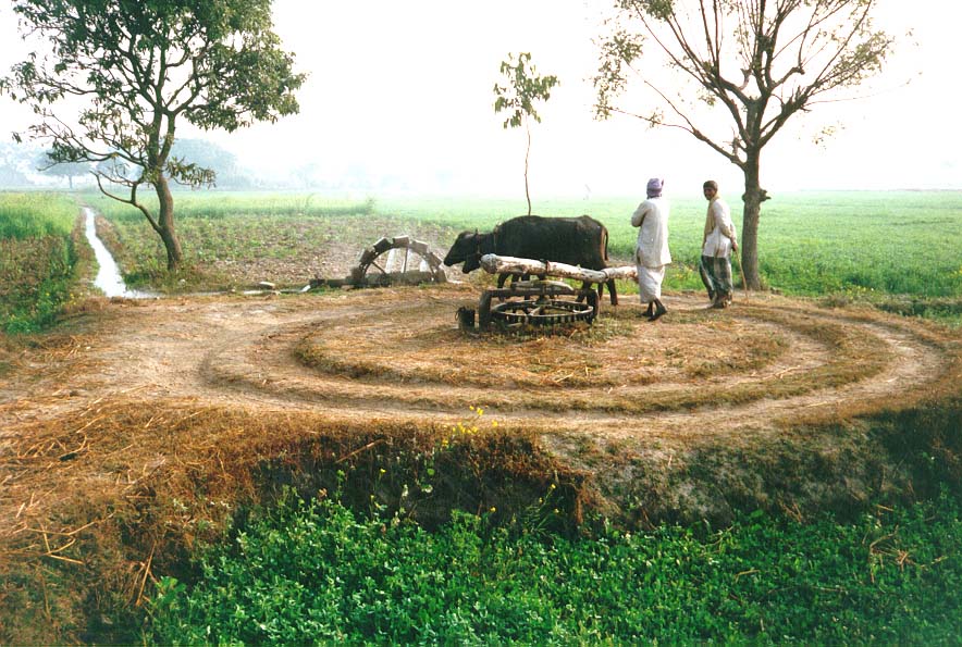
The system for elevating water is an elaboration or the Persian rehant system, sometimes called the Persian wheel. Chambers within the baolis and water raising houses contained wheels with shafts driven either by humans or cattle. These wheels in turn rotate shafts that drive a belt of earthenware water-filled pots, up to the next stage of the waterworks. This is an elaboration of the rehant system which is frequently seen in medieval, and contemporary, India village wells and agriculture, where a bullock is used to raise water from the well to ground level. Here the system is applied for multiple stages of elevation. The structures themselves are a mechanical elaboration of the traditional baoli, where the stepped path was a manual route through which to collect water. The rehant system of water-raising is labour intensive when applied on such a grand scale, to raise water in 5 stages to a total elevation of approximately 40m.
The rehant technology employed to raise water 40m to the ridge had been used in India prior to Mughal rule, as the Rani Stepwell, Nadol (c.1000 AD) proves(19). Thus the achievement of supplying water to the ridge was an engineering feat of scale rather than innovative technology. Innovation occurred in placing inhabitable water buildings within the two supply systems for raising water, creating buildings that were simultaneously pieces of machinery and social spaces.
It seems counter-intuitive to site the complex at an elevation of 40m from the water sources, particularly in an area of scarcity. However, in achieving the difficult task of supplying water to the ridge Akbar was asserting his personal authority and the power of the Mughal Empire to overcome obstacles. The mechanical process for raising water is relatively hidden, within the well buildings and water raising houses, giving the false impression that water appeared effortlessly at the storage tanks. In fact it was a highly laborious process driven by animal or human labour. In accomplishing this feat, Akbar demonstrated his power all the more effectively by concealing the means by which it was achieved.
Whilst the mechanical process of raising water was covert, the conveyance of water in channels was explicit. Some claim that artificial running water did not exist in North India prior to the reign of Babur(20). Evidence of the movement of water along the fort wall at Champaner indicates the existence of artificial running water in pre-Mughal India. Fatehpur Sikri contributes to this argument indicating that, regardless of whether running water existed in India prior to the Mughals, it became more explicit under their rule. The north baoli is evidence of this. Water is carried first by rooftop channel and then via an aqueduct to the water-raising house. This action is visible from the buildings on the north edge of the complex near the Elephant gate (Fig 23). Further expression of running water is seen in channels lining the terraces and leading to the north kund and in the aqueduct carrying water from Jodh Bai’s palace and the channels quartering the gardens.

(19)Livingston,2002, p.57. (20)Babur in Thackston, 1996, p.359 and Nath, 1985, p.xxxii.
Revealing an Attitude to Water


Petruccioli’s diagram(Fig 20.) illustrates that conveyance of water was explicitly used to structure space at Fatehpur Sikri. The groundwater supply systems climbed up the north and south sides of the ridge and the north system converged with drainage and run-off at Char-Chamand tank within Sahn-i-khass. Water channels lined terraces and courtyards and bisected gardens; the artificial lake contributed to the nature of the land north of the ridge as grounds for ‘leisure’(21). Experientially, water was selectively concealed, with many of the water structures deliberately occluded or subdued. From the form, location and accessibility of the structures we can infer exclusivity and possible uses.

The south L-shaped baoli is situated on the ‘modern road’ to Agra. This road may have been a trunk route, along which the well was located. Thus the well could have functioned, in the traditional manner of a stepwell, as a rest house for travelling tradesmen. The scale of the structure, including pillared galleries and two octagonal chambers, is sufficient to accommodate an intimate court of 60 people(22). This suggests that courtiers may have congregated within the well building, using the subterranean spaces adjacent to the water as cool summer retreats. Possible use of the building as a travellers’ rest house or court retreat is illustrative of the varied potential in the use of the well buildings.

In comparison, the north baoli, near to the caravanserai and hunting grounds north of the Elephant gate, was far less accessible. The well is of a smaller scale than the south well, with accommodation limited to two octagonal chambers adjacent to the shaft, external niche-like spaces, and the pillared corridor under the aqueduct. Direct access to water is distinct from access to the rooms, which can be entered directly from ground level by secretive stairs. These factors suggest this well was exclusive, potentially for use by smaller groups of the elite after hunting, and possibly for women of the harem, on separate occasions. Invisibility of the underground rooms from ground level makes use by women a possibility. Distinction between male and female accommodation is apparent in the suggestion(23) that the roofed tank in the southeast corner of Miriam’s garden was curtained to serve as a female bathing pool.
The baolis and surmised female bathing tank are in keeping with Jain-Neubauer’s observation of stepwells in the Gujarat area after Islamic rulers had established power over large areas in the 14th century,
"the stepwell as a religious(i.e. sacred) and public(i.e. utilitarian) edifice changed and the same form was used to build an edifice for private use, mostly in royal possession, as a cool retreat during the hot summer months."
(24)
The Jhalra outside the congregational mosque is an exception to this point. Proximity to the public mosque makes the structure accessible to civilians. The pillared galleries lining the stepped corridor to the tank are similar to those at the L-shaped well, providing space for retreat. These factors suggest that the Jhalra was a more public version of the L-shaped well, albeit harvesting rainwater as opposed to accessing groundwater.
Indic baolis and kunds were often isolated as water sources, but focal points for communities. The baolis and kunds of Fatephur Sikri invert these functions by being connected to the water supply systems but peripheral to the ridge complex. With the exception of Char-Chamand tank, they are not located centrally within the elite community.
The expression of running water coincides with a shift away from focusing attention on the water source. This shift is consistent with placing inhabitation at the centre of the water structure, where in an Indic kund, or Indo-Islamic retreat well, one would expect to find the water source. At Sat Kua Nav Vavdi, Champaner, a central room surrounded with water was interpreted as an expression of kingship. Fatehpur Sikri continues this theme. Char-Chamand tank(25) expresses kingship on two scales. Four bridges quarter the plan of the tank and lead to a central island platform with a raised seat. This arrangement not only inverts the source-inhabitation relationship of an Indic kund(26) but also inverts the common arrangement of the chahar bagh: the quartering water channels and central water source are replaced by the bridges and platform respectively and the garden quarters replaced by the water source. This is an emphatic expression of kingship.

Char Chamand is the focal point for the water systems, where run-off from the palace and the north waterworks converge. This situates the island platform at the centre of both the structure and the system of water management. Char-Chamand was said to be a site of social intercourse between Akbar and his courtiers(27), placing Akbar at the centre of the system. Therefore the structure is an expression of kingship on the scale of the tank and the complex as a whole. This interpretation echoes conjectures that the large baths were used as an informal throne room for Akbar to entertain his courtiers(28).

Surrounding rooms and structures with water is also seen at the Mahals and water pavilion. Todar and Hada Ka Mahals were built on island platforms within the lake (Fig 29.). Rizvi conjectures that at the water pavilion the octagonal room and the surrounding galleries were encased with cascades of water(29), an expression of exclusivity in the high level of thermal comfort achieved and of kingship in the central placement of the inhabitation.
The use of water to express kingship coincides with concern for thermal comfort. Extreme dry heat occurs at Sikri for approximately four months of the year. Surrounding inhabitation with water would result in evaporative cooling benefits. Domed spaces line the walls of both the north and south kunds. The use of these spaces is unknown, but they make use of the thermal mass of both the masonry walls of the kund and the water contained within.

Baolis are known for using subterranean spaces, water and the well as a courtyard to provide cool retreats primarily for summer use. The hammams of Fatehpur Sikri were used throughout the year, requiring cooling in summer and heating in winter(30). Using environmental strategies employed at the hammams of Agra fort, the heating systems include hypocaust fires and floors, ceramic pipes to convey hot water and water tanks within the walls. An additional development is a double-vented roof. The cooling strategy of the hammams is unclear, but Nath and Petruccioli suggest that saltpetre(potassium nitrate) was used(31). Could this have been an early example of the use of phase change materials to cool interior spaces?
Water buildings at Fatehpur Sikri are distinctive for their composite nature. The south baoli combined elements of an Indic stepwell (L-shaped stepped corridor), Islamic hammam(domed room) and retreat well(corridor and rooms surrounding the well shaft, discrete stairs) with new features such as the beams spanning across the rooms for supporting rehant apparatus; an additional storage well and pillared galleries lining the stepped corridor. The Jhalra used the arrangement of a baoli for a structure that harvested rainwater and collected run-off. Formal and typological ambiguity extends to the utilitarian water raising houses (Fig 31.). From outside, these three-domed structures appear as small hammams, but within are houses for machinery. This contrasts with the actual hammams at Fatehpur Sikri, where a similarly subdued external appearance often belied the fine interiors.

The playful use of elements of Indic and Islamic water structures is a consequence of the synthetic nature of Akbar’s architecture and an attitude to geometry. Through annexation of Gujarat(1573) Akbar was exposed to Gujarati water architecture, which by this time was an established synthesis of Hindu, Jain and Islamic elements. Asher states that it is,
"generally assumed that the artisans from Akbar’s palaces came from Gujarat,"
(32)
which may also apply to the water architecture at Fatepur Sikri. Akbar’s willingness to include those of different religious and cultural groups within his court and under his employment led to a design that was synthetic of cultural influences. The use of post and beam construction is both a continuation of Indic traditions of Gujarat and characteristic of the lightweight architecture developed to suit the itinerant culture of the Mughals, here applied using heavyweight red sandstone construction. The variety in geometric order, which is rigidly defining both at the north baoli and Char-Chamand, suggests an ambiguous sacred importance attributed to these structures. In buildings that were clearly religious in nature, a strong geometric order was a likely prerequisite, whereas in palatial structures rigid geometry was arguably dispensable(33). In the water structures, the majority of which are palatial, there is an opportunity for the playful combination of forms that characterises the south well.
(21)Rivzi refers to this area as Chaugangah(Polo Ground), 1975, p.115. (22)Conversation with Mark brand 26th Feb 2009. (23)Nath, 1985, p.177. (24)Jain-Neubauer, 1981, p. xv. (25)Also known as Anup Talao. (26)Pavilions and landings line the walls of the kund and there is a central source. (27)Nath, 1985, p.171. (28)Petruccioli, 1988,p.59. (29)Rizvi, 1975,p.117. (30)Ford and Hewitt, 1996, p.66. (31)Nath, 1976, p.45, Petruccioli, 1988, p.58. (32)Asher, 1992, p.10. (33)Conversation with Mark Brand, Feb 2009.
Conclusions
The water structures of Fatehpur Sikri are remarkable for the high level of integration of functions as machinery, social spaces, climatic mitigators and expressions of kingship. A result of this integration is a potential overlay in the use of the spaces. A rehant chamber in one of the baolis could also serve as a royal retreat room. The great baths could function as an informal throne room. A roofed water tank could be curtained to serve as female baths.
Such elaborate water systems and structures strongly challenge the myth that Fatehpur Sikri was abandoned by the Mughal court for lack of water(34). Functioning of the laborious systems required the elite to command labour and control the systems. Once the court had departed, the functions of the systems would likely cease. This was not civilian city, driven by commerce and seemingly chaotic, but rather an idealised conception of a city driven by political and creative will. That the complex was desolate soon after the departure of the ruler indicates the importance of the elite to the functioning of the city. Although it is difficult to argue that the abandonment by the court was due to drought, it is possible that the subsequent desolation was due to insufficient water that resulted once the social structure that built and maintained the systems had departed.
Lessons for history
The water architecture of the city reveals values across utilitarian, environmental, political, social and religious fields. Fatehpur Sikri was an artificial topography, with a general urban order defined by the relationship between the terraces. The city was explicit in the use of running water to structure space but covert about the source, use of associated spaces and the mechanical process of raising water.
Sikri indicates a general shift in the role of the most refined water structures, from public and sacred to exclusive and palatial. This move corresponds with a shift in architectural expression from the applied to the integral, an increased concern for thermal comfort, and the dispensability of rigid geometry, resulting in sophisticated environmental strategies and formal playfulness.
Exceptions to this general shift are the Jhalra and L-shaped baoli of Fatehpur Sikri, which suggest access to refined Indo-Islamic water buildings was not entirely exclusive to the elite.
The resulting formal playfulness, in which elements of both Indic and Islamic architecture are combined, is indicative of a lack of religious exclusivity to water architecture. Structures developed strong relationships to the religious institutions of the temple and mosque, but were not exclusively tied to them.
The shift in expression of meaning from the applied to the integral was strongly motivated by a political desire to express kingship. By enveloping inhabitation with water and situating themselves at the centre of water bodies, Akbar sought to assert authority as well as attain high standards of thermal comfort.
Akbar’s achievement went beyond the primary needs of the city and provided water for luxury in an area of scarcity. However, this was achieved through bias in the social function of water architecture towards the elite, resulting in a reduction in the role of water buildings as public gathering places, leaving many of the public structures as purely utilitarian. This bias is reflected in the short-lived nature of the city. As although lack of evidence makes it difficult to argue that the sites were abandoned due to lack of water, the functioning of the water systems and cities was dependent on the presence of the elite.
Lessons for today
Fatephur Sikri does not mark great developments in hydraulic technology in India. Rather, the relevance of the designs lies in the treatment of water as both an architectural and environmental issue, integrating social, political, religious and environmental attitudes to derive solutions on both an urban and architectural scale. Much of the importance of Indian water architecture, dating back to the earliest examples, comes from the primary need for perennial water sources in combination with the associative value attributed to the element, a value heightened by its scarcity. In a contemporary context, where water is deceptively easily available by tap and the associative value diminished, historic structures may seem irrelevant. However, certain aspects of the sites have a penetrating relevance to contemporary situations.
Careful sectional planning enables an efficient re-use of wastewater. This is an appropriate strategy to deal with the persistent problems of water in a seasonal monsoon climate. It has the potential to structure both an urban order and the sectional relationships between different elements of individual buildings, such as a house, which could be planned in relation to a hierarchy of uses of water. The combination of groundwater, rainwater and run-off collection, employed at Fatephur Sikri, is sensible, as it reduces the danger of exhausting one means of supply.
The appropriation of public water architecture for structures that were exclusive to the elite led to technical advances in environmental strategies to optimise the use of water for pleasure. Detailed analysis of the cooling and ventilation strategies of the baradari, elite residences and hammams of Fatephur Sikri could enable the design of low-energy cooling strategies for buildings in arid climates.The suggestion that the use of saltpetre for cooling in the hammams of Fatehpur Sikri was an early example of the use of phase change materials needs to be further explored. Simply applying these principles as technical solutions would, however, be an inadequate architectural response, as this ignores the issue of associative value. A reassessment of the meaning of water in a contemporary, primarily but not exclusively, Indian context, in which water is an important commodity and one of the key issues of climate change, but also retains religious significance, may introduce tension between economic, environmental and religious forces but also provide formal and iconographic richness. Contemporary context also suggests the re-discovery of the social role of water architecture as an activator of community, a public role that runs counter to the appropriation of village and agrarian traditions primarily for elite usage witnessed at Fatehpur Sikri. The opportunity exists to re-apply the developments and innovations that occurred in ‘exclusive’ water architecture to contemporary public situations, to form community water sources that are places of exchange, cool environments for pleasure and reflective of current associative value. This is not suggesting a return to medieval hydraulic technology, but rather a re-discovery of the potential of water to be both managed efficiently in areas of scarcity and extreme heat, and to be used to structure communal spaces, buildings and cities.
(34)Nath, 1985, p.176 and Petruccioli, 1988, p.102 dispute the myth.
Glossary
- baoli /vav stepwell
- baradari pavilion
- birkha underground vaulted reservoir
- chahar bagh four-fold garden
- durwaza gate
- hauz pool, tank
- hammam bathhouse
- Hisar-i-khass royal citadel
- jami masjid congregational mosque
- jhalra water storage tank
- Jahanpanah civilian city
- kund/kunda stepped pond
- mahal palace
- Sahn-i-khass royal complex
- Sahn-i-Rayyat public court
- talao lake
Bibliography
Books.
- Hegewald, Julia, Water Architecture in South Asia: a study of types, developments and meanings(Leiden: Brill, 2002).
- Jain-Neubauer, Jutta, The Stepwells of Gujarat in an art-historical perspective(New Delhi: Abhinav Publications, 1981).
- Livingston, Morna, Steps to Water: The Ancient Stepwells of India, ed. by Clare Jacobson(New York: Princeton Architectural Press, 2002).
- Nath,R, History of Mughal Architecture, II(New Delhi: Abhinav Publications, 1985).
- Smith, Edmund W, The Moghul Architecture of Fathpur-Sikri, 4 vols(Allahabad: Supdt, Govt Press, 1894-98).
- Smith, Edmund W, Portfolio of Indian Architectural drawings(London:W.H Allen & Co [et al.], 1897).
- Alam, Muzaffar., ed., and Sanjay Subrahmanyam., ed., The Mughal State(New Delhi: Oxford University Press, 1998).
- Asher, Catherine, Architecture of Mughal India(New York:Cambridge University Press, 1992).
- Beveridge,H ., trans., Akbarnama of Abu-l-Fazl(Calcutta: Asiatic Society, 1897-1921).
- Brand, Michael., ed., and Glenn D Lowry., ed., Fatehpur-Sikri: a sourcebook(Cambridge, Mass. : Aga Khan Program for Islamic Architecture at Harvard University and the Massachusetts Institute of Technology, 1985).
- Fatehpur Sikri(Bombay: Marg Publications, c1987).
- Brown, P, Indian Architecture:Islamic Period(Bombay: D.B. Taraporevala Sons, 1968).
- Chandra, Satish, Medieval India: from Sultanat to the Mughals(New Delhi: Har-Anand Publications ltd, 1999).
- Eaton, Richard M, ‘Temple Desecration and Indo-Muslim States’ in., Beyond Turk and Hindu: rethinking religious identities in Islamicate South Asia, ed. by David Gilmartin and Bruce B Lawrence(Gainsville: University Press of Florida, c2000).
- Jain, Kulbhushan and Minakshi, and ed. by Dhananjaya Singh, and Meghal Arya, Architecture of the Indian Desert(Ahmedabad: AADI Centre, 2000).
- Koch, Ebba, Mughal architecture : an outline of its history and development 1526-1858(München: Prestel, c1991).
- Nath,R, Some Aspects of Mughal Architecture(New Delhi: Abhinav Publications, 1976).
- Nath,R, Architecture of Fatehpur Sikri, Supplement to History of Mughal Architecture(Jaipur: The Historical Research Documentation Programme, 1988).
- Nath,R,Islamic Architecture and Culture in India(New Delhi: B.R Publishing Corporation, 1982).
- Pandya,Yatin, Concepts of Space in Traditional Indian Architecture ed. By Kagal, Carmen (Ahmedabad: Mapin Publishing Pvt. Ltd, 2005).
- Petruccioli, A, Fathpur Sikri : città del sole e delle acque(Rome: Carucci, 1988).
- Petruccioli, A, Fathpur Sikri: la capitale dell'impero Moghul, la meraviglia di Akbar(Milan, Mandadori Electa, 2007).
- Pullan, Wendy, ‘Islamic Gardens’, in Encyclopaedia of Gardens: History & Design, II, ed. by A Shremaker (Chicago: Fitzroy Dearburn Publishers, 2001) p.641-643.
- Rizvi,Saiyid Athar Abbas and Vincent John Adams Flynn, Fathpur-Sikri(Bombay: D.B. Taraporevala Sons, 1975).
- S. R. Rao, Lothal (Archaeological Survey of India, 1985).
- Thackston, Wheeler M., ed. and trans., The Baburnama: memoirs of Babur, prince and Emperor(Oxford: Oxford University Press, 1996).
- Tilloston, Giles., ed., Stones in the Sand: The Architecture of Rajasthan(Mumbai: Marg Publications, 2001).
- Verma, Chob Singh, The Wonder that was Sikri(Delhi: Rahal Publishing House, 1996).
Journal Articles.
- Ford, Brian and Hewitt,Mike, ‘Cooling without Air-Conditioning – Lessons from India’, Architectural Research Quarterly, vol.1 no.4(Summer 1996),p.60-69.
- Petruccioli, Attilio, ‘The Process Evolved by Control Systems of Urban Design in the Mogul Epoch in India: The Case of Fatehpur Sikri’, Environmental Design: #Journal of the Islamic Environmental Design Research Centre, 0(1984), 18-27.
- Pieper, Jan, ‘Water in Hindu Urban Architecture’, AARP(June, 1979), p.39-44.
- Shokoohy, Mehrdad and Natalie H, ‘Pragmatic City Versus Ideal City: #Tughlagabad, Perso-Islamic Planning and its impact on Indian Towns’, Urban Design Studies, 5(1999), p.57-84.
- Wagoner, Philip B. and John Henry Rice, ‘From Delhi to Deccan: Newly Discovered Tugluq Monuments at Warangal-Sultanpur and the beginnings of Indo-Islamic Architecture in Southern India’, Artibus Asiae, 61(2001), p72-117.
- Wescoat, James L., Jr. ‘Early Water Systems in Mughal India,’ Environmental Design: Journal of the Islamic Environmental Design Research Centre, 2(1985), p 50-57.
Unpublished work.
- Vasavada, Rabindra, supervisor, RSP Drawing of the waterworks of Fatehpur Sikri(CEPT University, Ahmedabad, 1978).
- Harmani, Pravin B, Medieval Town Planning in India(Thesis, CEPT University, Ahmedabad 1970).
- Makower, Timothy, Water and stone in Fatehpur-Sikri: An essay on servicing and construction(4th year essay, University of Cambridge, 1989).
- Vora, Kartik, Subterranean Architecture a forgotten tradition of Sultanate Gujarat(Master’s Thesis, CEPT University, Ahmedabad, 1982).
Websites.
- http://www.archnet.org.
- http://www.harappa.com/har/indus-saraswati.html.
- http://www.fao.org/docrep/010/ah810e/AH810E49.gif.
- http://www.pashaurasinghdhillon.com/wp-content/uploads/2010/08/persianwheel.jpg.
- http://www.bbc.co.uk/news/magazine-18491900).
- http://4.bp.blogspot.com/-nozKosoIKzY/TvXgnxd9NeI/AAAAAAAAAZU/Ji79Li_Kk5M/s320/india_rivers.png.
- http://www.targeticse.co.in/wp-content/uploads/2010/03/river_map.JPG.
- http://random-gs.blogspot.com/2012/06/major-rivers-of-india-map.html.
- http://photos.worldisround.com/photos/24/144/304_o.jpg.
- http://www.google.co.in/imgres?q=varanasi+cremation+ghat&start=161&hl=en&biw=1279&bih=680&tbs=isz:l&tbm=isch&tbnid=QcxWNKoJvngCiM:&imgrefurl=http://cohn17.com/2011/02/02/16-21-january-2011-manikarnika-ghat/&docid=efYtgLl7Rx2rEM&imgurl=http://cohn17.files.wordpress.com/2011/02/20110119_varanasi_512.jpg&w=1440&h=958&ei=E9xtUKrPFtOO0QHc9oGwDA&zoom=1&iact=rc&dur=3&sig=100622233335796484049&page=9&tbnh=125&tbnw=188&ndsp=22&ved=1t:429,r:7,s:161,i:238&tx=105&ty=57.
- http://thewriterandthewanderer.blogspot.com/2011/02/offering-on-ganges.html.
- http://classconnection.s3.amazonaws.com/686/flashcards/769686/jpg/image11330192026434.jpg.
- http://www.aboardthedemocracytrain.com/saving-the-ruins-from-ruination.
- http://www.ahmedabadcity.com/tourism/html/ar_lothal.html.